Usable Acreage vs. Total Acreage: How to Evaluate Rural Land in Eastern NC
Land & ruralTags:
By Carroll Harrod · Salt & Soil Realty Group
Ten acres can mean ten very different things.
One tract may offer a clear homesite, a good driveway approach, open ground for animals, and woods along the back. Another ten-acre parcel may be mostly low ground with a narrow strip of suitable land near the road. Both contain ten acres, but they do not offer the same options.
That does not mean every acre needs to be cleared, dry, or buildable. Woods, wetlands, creek bottoms, and field edges can provide privacy, wildlife habitat, timber, recreation, and natural drainage.
Salt & Soil Realty Group is a real estate brokerage, not a surveyor, engineer, septic installer, or environmental consultant. This post is educational; confirm land, wetland, septic, and access questions with licensed professionals before closing.
See cost to make raw land buildable, utilities on rural land, and buying a home with land near Jacksonville.
Carroll Harrod with Salt & Soil Realty Group helps buyers of land and rural property in Jacksonville, NC, Onslow County, and Coastal North Carolina—including septic, wetlands, and access due diligence.
The better question is not, “How many acres am I buying?”
It is:
- How much of this property works for the things I want to do, and what value do the remaining acres provide?
For the full land-buying process, start with Buying Land in Eastern North Carolina: What to Check Before You Make an Offer.
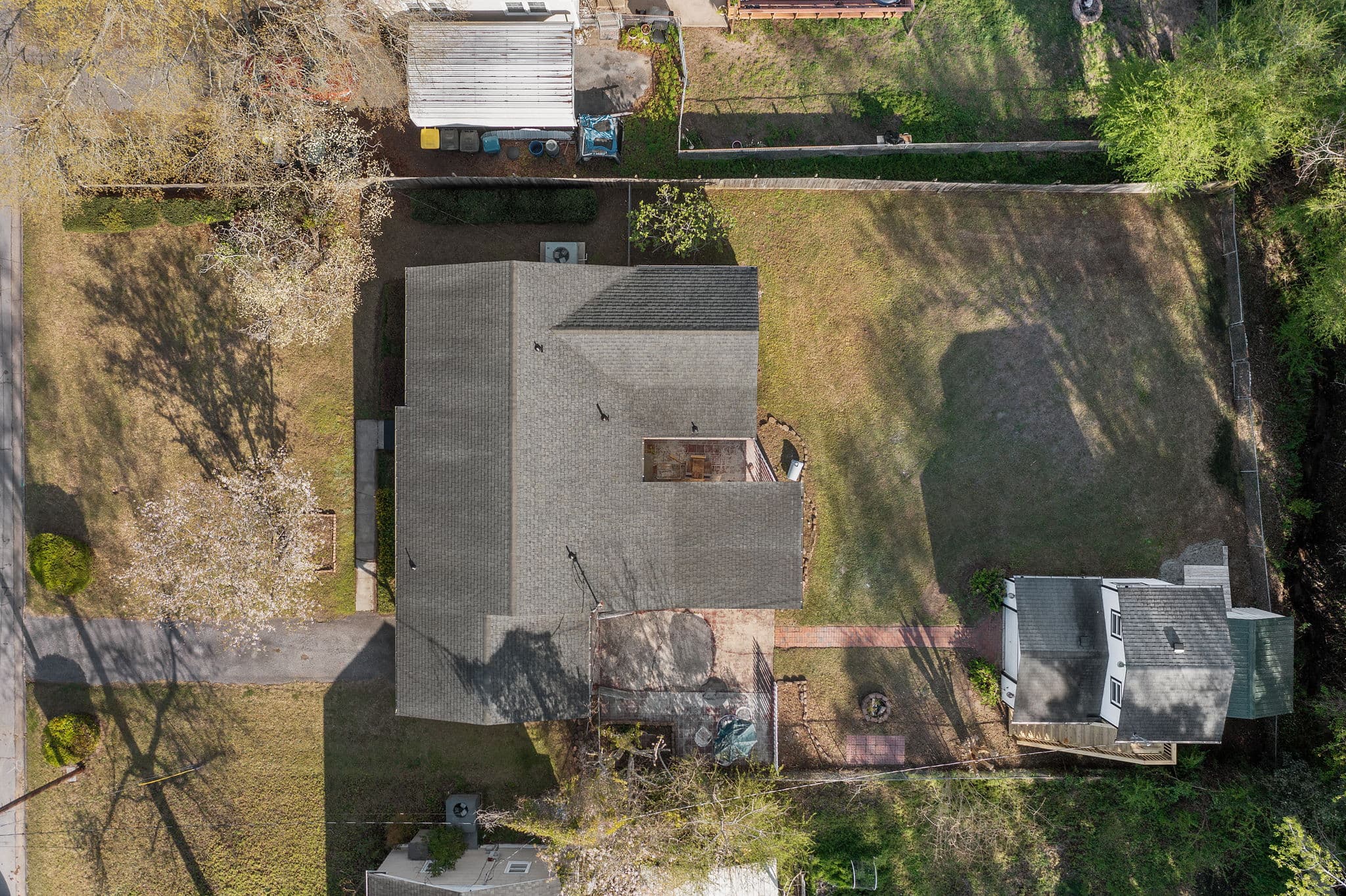
Usable Acreage Depends on the Plan
A buyer looking for one house and a wooded buffer may view the property differently from someone who needs open pasture, a large shop, and room for a second dwelling.
Before judging the acreage, decide what needs to fit:
- The house and yard
- Driveway and parking
- Septic system and repair area
- Well or public-water line
- Garage, shop, or barn
- Pasture or fencing
- Garden or orchard
- Equipment storage
- Hunting or recreational ground
Future additions or another homesite
A five-acre parcel may be more than enough for a house, shop, and garden when the land lays well. Twenty acres may feel surprisingly limited when the only suitable building area is narrow, difficult to reach, or separated from the road by wet ground.
This is why acreage should be evaluated by function, not just size.
Find the Best Ground for the House and Septic System
For residential land, the most important usable area is usually the part that can support the house, access, and wastewater system together.
The prettiest place for the house may not have the best soil for septic. The most suitable septic area may sit where the buyer first imagined placing a shop or driveway. A low purchase price can lose some of its appeal if the layout requires extensive clearing, a long driveway, or a more complicated wastewater system.
The house and septic plan should be considered together before either location is treated as final.
Our guide to buying land with septic in Eastern NC explains how soil evaluations, bedroom counts, drainfields, and repair areas can affect the usable part of a parcel.
A septic area is still useful land, but it may need to remain free from buildings, heavy traffic, and other improvements. Buyers should not count the same section of ground for the drainfield, detached garage, pool, and future addition.
Make Sure the Usable Ground Is Accessible
Good ground has limited value as a homesite if the buyer cannot reach it without crossing a ditch, wet area, neighboring property, or expensive stretch of road.
When you walk the parcel, look at the route from the public or private road to the likely building area. Consider how ordinary vehicles, construction trucks, utility crews, well equipment, and emergency vehicles would get there.
The access may be completely workable but require a culvert, clearing, gravel, drainage improvements, or a longer driveway than expected.
Legal access matters too. A path that has been used for years does not necessarily establish road frontage or a recorded easement.
The companion article Does This Land Have Legal Access? What Eastern NC Buyers Should Verify covers public frontage, private roads, maintenance agreements, construction access, utility rights, plats, and surveys.
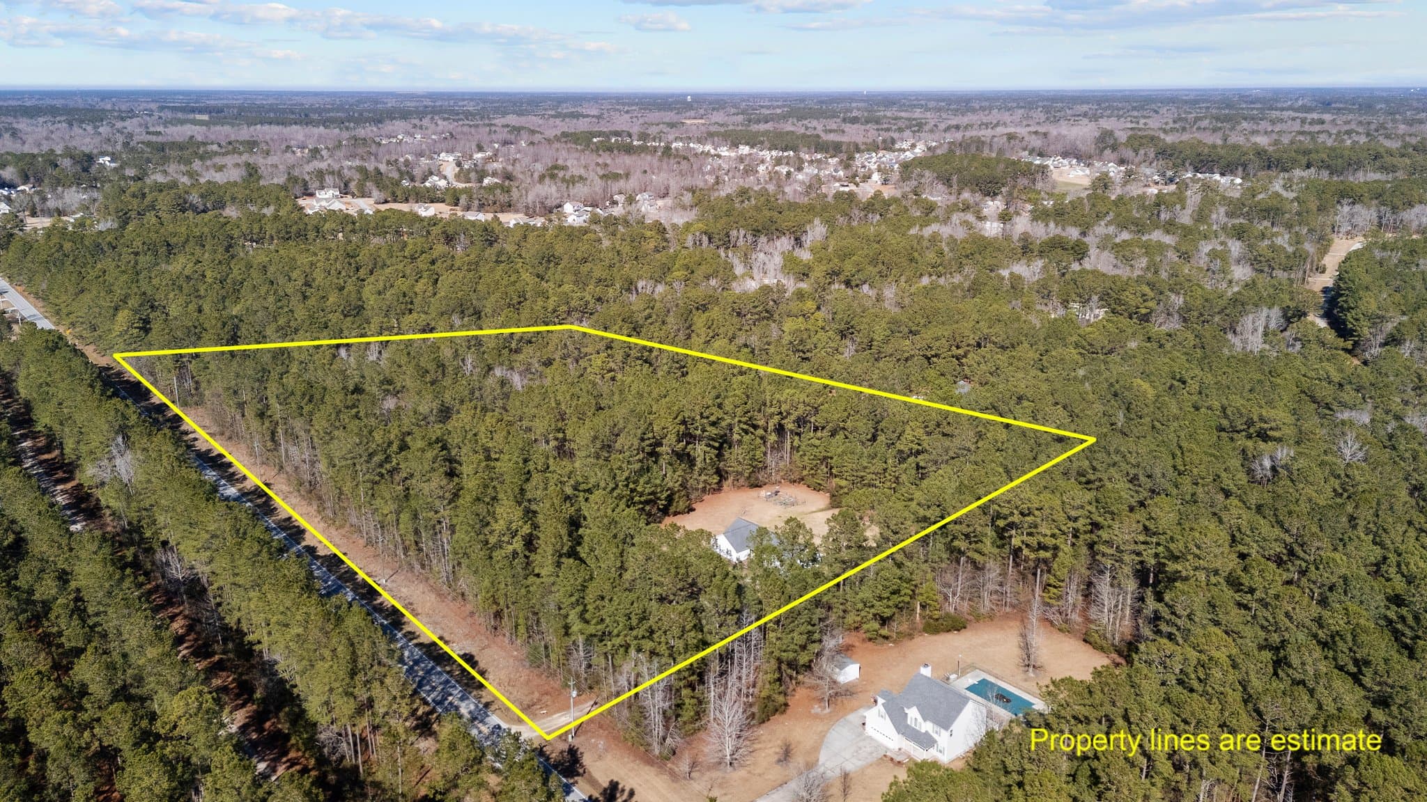
Wet or Wooded Acreage Is Not Automatically Wasted Acreage
Buyers sometimes see mapped wetlands or low woods and immediately subtract those acres from the property’s value.
That can be too simplistic.
Wetlands may limit where a house, driveway, septic system, or outbuilding can be placed. They may also provide privacy, wildlife cover, water storage, hunting opportunities, and a natural buffer from neighboring property.
The concern is whether enough suitable upland remains for the buyer’s primary plans.
For example, a fifteen-acre tract with four acres of well-positioned upland near the road may work beautifully for a homesite, shop, and garden. The remaining woods and wet areas may provide exactly the privacy and recreational value the buyer wanted.
On another parcel, the same amount of upland may sit behind a wet crossing or in a shape that makes the house, septic, and driveway difficult to arrange.
Online maps can help flag possible wetlands, but they do not settle every property-specific question. Salt & Soil’s guide to wetlands in Coastal North Carolina explains mapped wetlands, field conditions, usable upland, and professional wetland determinations in more detail. (Salt & Soil Realty Group)
Floodplain and wetlands are not the same thing. A parcel may also have drainage concerns outside a mapped high-risk flood zone. Buyers who need a deeper explanation of maps, elevation, drainage, and insurance can review the Salt & Soil guide to Jacksonville-area flood zones and insurance costs.
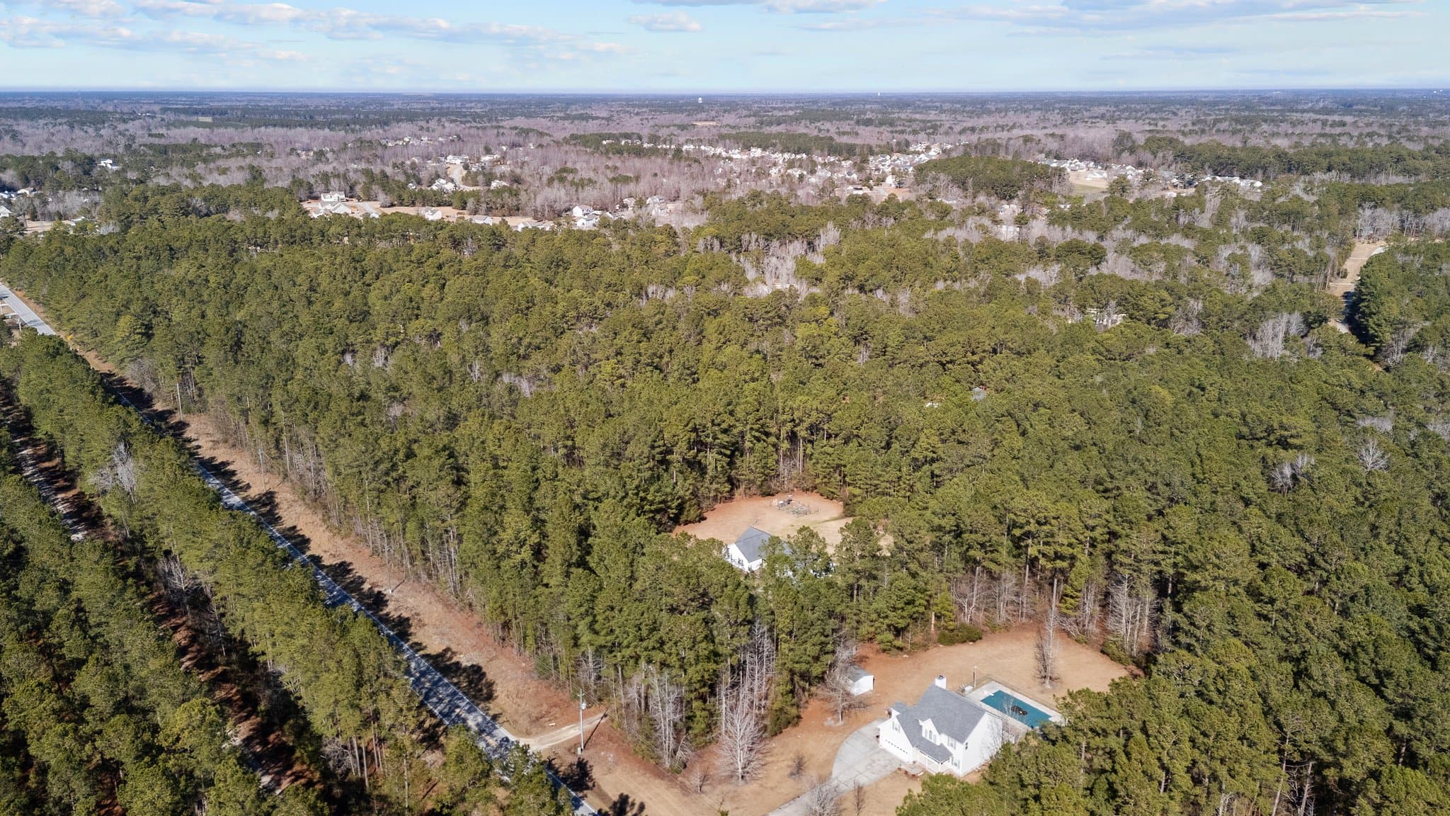
Woods, Fields, and Open Ground Serve Different Purposes
Open acreage is easy to picture as pasture, a garden, or a building site. Wooded acreage takes a little more imagination.
A mature timber stand may offer shade, privacy, hunting, future timber value, or a natural buffer. Younger pine stands may need thinning or other management over time. Thick cutover land can provide wildlife cover but may require substantial clearing before it supports a house or pasture.
Open fields are not automatically ready for every use either. Drainage, soil, fencing, water access, weeds, and previous agricultural practices all affect how quickly the land can become productive pasture or garden ground.
Walk the tract with the intended use in mind.
A buyer interested in wildlife or hunting land may value creek bottoms, field edges, pine stands, and natural transition areas differently from someone who wants most of the acreage in pasture.
Salt & Soil’s article on wildlife habitat management in Coastal North Carolina gives a closer look at how different parts of a rural tract can contribute to habitat and long-term land use. (Salt & Soil Realty Group)
Do Not Rely on the GIS Acreage Alone
County GIS is a useful starting point for seeing the parcel’s general shape, roads, neighboring ownership, and recorded acreage. Onslow County notes that its digital cadastral information represents recorded plats and surveys for GIS use. It should not be treated as a replacement for a current field survey when boundaries matter. (Onslow County Maps)
That distinction becomes especially important when a fence, field edge, driveway, ditch, or timber line appears to mark the boundary.
The actual line may not follow the feature you see on the ground.
A survey can help confirm:
- Total acreage
- Boundary lines and corners
- Road frontage
- Easements and rights-of-way
- Encroachments
- The shape of the parcel
How much room exists for the planned improvements
Acreage alone can also hide awkward dimensions. A long, narrow tract may contain plenty of square footage while offering fewer practical building arrangements than a more compact parcel.
Walk the Property More Than Once When Possible
Land can look different depending on the weather and time of year.
A dry summer visit may not show where water stands during winter or after several days of rain. Thick leaves can hide ditches, neighboring structures, or the way the ground slopes. Recently cut vegetation may make an area look more open than it will be without continued maintenance.
A second visit can help confirm whether the first impression holds up.
Bring a rough idea of where the house, driveway, septic system, and outbuildings might go. You do not need a finished site plan, but you should be able to picture how the major pieces fit without forcing every improvement into the same small section.
Bottom Line
Usable acreage is not always the same as cleared acreage or buildable acreage.
Some land may support the house and septic system. Some may work better for pasture, timber, hunting, habitat, privacy, or drainage. A good rural property often includes several types of ground serving different purposes.
The right parcel is not necessarily the one with the largest acreage number. It is the one where enough suitable land exists for your priorities and the remaining acreage adds value you will actually use.
Salt & Soil Realty Group helps buyers compare land and rural property throughout Onslow County and Eastern North Carolina. Carroll Harrod can help you look beyond the acreage shown in the listing and evaluate how access, soil, water, woods, open ground, and future plans fit together.
Landowners interested in improving soil, pasture, timber, erosion control, or habitat after closing can also read How NRCS Helps North Carolina Landowners. (Salt & Soil Realty Group)
Frequently Asked Questions
What does usable acreage mean?
Usable acreage is the part of a parcel that works for the buyer’s intended purposes. It may include a homesite, septic area, driveway, pasture, garden, timber, hunting ground, or recreational space. The definition changes depending on what the buyer wants from the land.
No. Many valuable rural properties contain woods, wetlands, floodplain, or other areas that are not intended for buildings. Those acres may still provide privacy, habitat, recreation, timber, or natural drainage.
Begin with parcel maps, flood and wetland screening tools, septic records, road access, and a careful site walk. A survey, soil evaluation, builder, forester, engineer, or environmental professional may be needed depending on the intended use.
Not automatically. Wooded land may offer timber, privacy, hunting, shade, habitat, or recreational value. Its usefulness depends on the type and condition of the woods, access, management needs, and the buyer’s goals.
GIS is useful for early research, but it is not a substitute for a current survey. A survey can confirm acreage, boundaries, frontage, easements, and how existing features relate to the property lines.
Research References
Salt & Soil: Wetlands in Coastal North Carolina
Salt & Soil: Wildlife Habitat Management in Coastal North Carolina
Salt & Soil: How NRCS Helps North Carolina Landowners
Questions about land or rural property in Coastal North Carolina? Contact Salt & Soil Realty Group.